


Land survey with drone
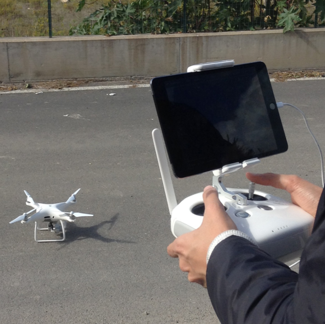 OWAC uses, for its activity, Remote Aircraft Systems (SAPR) with the aim of developing a three-dimensional measurable model, in scale, of the detected areas and obtain high resolution orthophotos of the areas to be designed or monitored. The aerophotogrammetry with drones allows the survey of the characteristics of the terrain otherwise not perceivable at ground level and allows obtaining metric and geographic information such as position or shape of three-dimensional objects by processing digital photos. With reference to the industrial plants, moreover, it allows the undoubted advantage of monitoring, even through the use of infrared cameras, plant sections that are difficult to reach. Our activity aims at the realization of precision surveys of complex morphology areas, with excellent results in the case of large extent reliefs, such as quarries or landfills, providing a complete model (DEM, DSM, DTM) with centimeter accuracy, responding to reality and georifierito. The centimeter accuracy, combined with the detailed three-dimensional reproduction of the ground is essential for the precise characterization of the progress of excavation work in environments subject to frequent transformations.
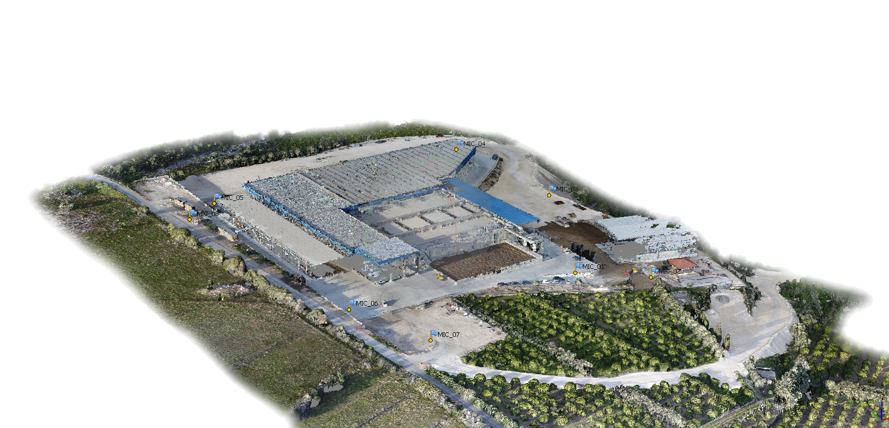
Monitoring of landfill / quarry excavations
 During the construction phase of a landfill, the survey with drone allows the control of the excavation phases and the calculation of the volumes (earthwork and carryover) of the earth movements carried out. Moreover, in this phase the technology allows the verification of the correct execution and modeling of the slopes even in the hardly accessible points.
Monitoring of landfill locks / settlements
 During the post-landfill monitoring phase, the monthly surveys with SAPR systems allow the management of the topographic monitoring and control of settlements over time of the wastes and the eventual subsidence of the embankments and the septa of the bucket tanks.
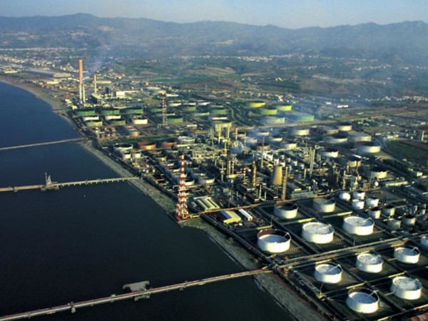
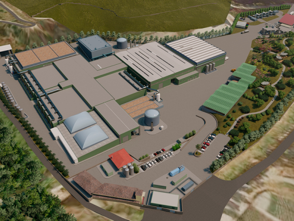
Monitoring of construction works for industrial plants
 During the construction of an industrial plant, the use of the drone allows, through regular surveys, to verify and check the exact continuation of the works, having a privileged view on the area. Moreover it is particularly suitable in the realization phase of the plants, also through the use of infrared cameras in the control of plant sections difficult to access.